Conference Venue
Discover the beautiful campus of JUIT in the heart of the Himalayas and explore the scenic beauty of Himachal Pradesh.
Jaypee University of Information Technology (JUIT)
Department of Biotechnology and Bioinformatics;
PO Waknaghat, Teh. Kandaghat, Distt-Solan
Himachal Pradesh, INDIA. Pin- 173234
PO Waknaghat, Teh. Kandaghat, Distt-Solan
Himachal Pradesh, INDIA. Pin- 173234
The University is situated in the neighborhood of Shimla, 3 KM off the NH22. It offers state-of-the-art facilities nestled in the serene environment of the Himalayas, providing the perfect setting for academic exchange and innovation.
Campus WiFi
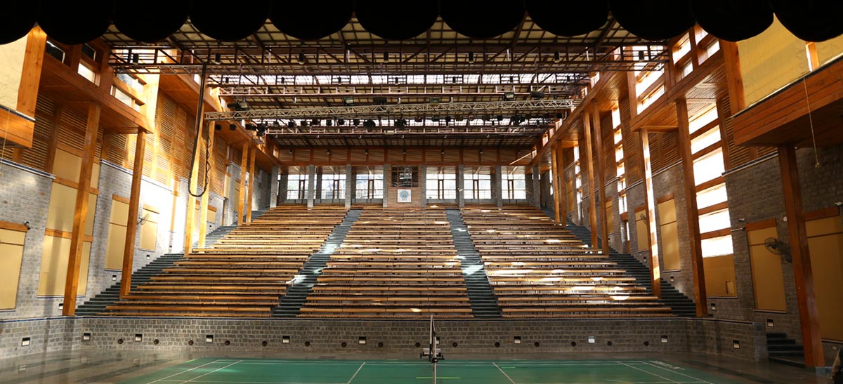
Smart Auditoriums
Cafeterias
Scenic Views
Tourist Attractions
Explore the beauty of Himachal Pradesh
Shimla
- By Air: The airport is at Jubbarhatti, 23 km from Shimla city and is connected to Delhi.
- By Rail: Shimla is connected by a broad gauge line up to Kalka (90 km). The journey takes about six hours via the heritage Toy Train.
- By Road: Connected by road to all major cities in north India. Volvo AC and deluxe buses ply from Delhi and Chandigarh.
Dharamshala, Kangra & Palampur
- By Air: Airport at Gaggal is 14 km from Dharamshala.
- By Rail: Pathankot is the closest broad gauge railhead (85 km from Dharamshala).
- By Road: Accessible from NH-20. An interesting variation is taking the train to Jalandhar or Una and then traveling by road.
Kullu & Manali
- By Air: Bhuntar airport (10 km from Kullu, 50 km from Manali).
- By Road: Connected by an extensive network of roads. NH-21 runs through the valley connecting Chandigarh and Delhi (535 km).
Dalhousie & Chamba
- By Air: Closest airport is at Gaggal (Kangra), approx 125 km from Dalhousie.
- By Rail: Nearest railhead is at Pathankot (85 km).
- By Road: Both towns are well connected by road.
Nahan, Paonta & Renuka (Sirmaur)
- By Air: Closest airport is at Chandigarh.
- By Rail: Nearest railheads are at Ambala and Kalka.
- By Road: Regular bus service from Ambala, Chandigarh, Kalka, and Dehradun.
- Distances: Paonta Sahib is 45 km and Renuka is 38 km from Nahan.
Local Taxi Contacts for Sightseeing
| Name of Owner/Driver | Location | Contact Number |
|---|---|---|
| Deepak | Waknaghat | 09817067767 |
| Sandeep | Waknaghat | 08894350203 |
| Rajesh | Waknaghat | 09857346503 |
| Dev | Shimla | 08628801445 |
| Taxi Service | Shoghi | 09861051332 |
| Devender | Waknaghat | 09805239881 |
| Joginder | Waknaghat | 09816335683 |
| Mukesh | Waknaghat | 09218799990 |